
Visit a City versus Google My Maps: which is better for visually planning your travel itinerary
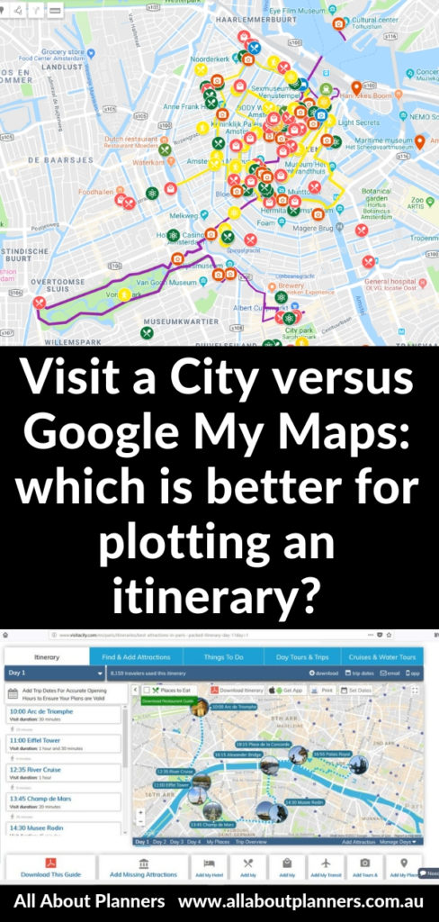
I’m a visual person (hence my love of color coding) so when I’m planning a holiday I like using maps to plot where all the things I want to see are, photo stops,so I know what location to look for a hotel in, how far apart things are etc.
There are many map plotting / photo stop itinerary mapping tools on the internet – Visit a City and Google My Maps are my favorite.
View the rest of my trip planning posts here.
Trip planning map plotting tools
This is not a sponsored post – I just really love these trip planning tools.
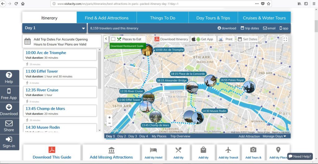
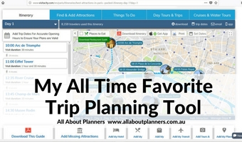
1. Visit a City
This is my favorite trip planning tool. Not only does it give you suggested itineraries for 1 day, 2 day, 3 etc. right up to 7 days, but it also plots them for you on an interactive map.
Pros of Visit a City:
- Pre-plots the locations on the map
- Comes with pre-built itineraries for popular cities only (not regional destinations unfortunately)
- Can print the map and take it with you
- Also have an app for your phone that syncs with the online tool if you’re logged in
- Destinations give you a review rating and a bit about each location so you can decide if it’s worthwhile
- Click on an attraction will take you straight to tours you can book to go and visit it as well as a rating
- Can filter each of these activities as well by , price, rating etc.
- Can add notes against each attraction e.g. you can add the cost, or the meal you want to order at that restaurant etc.
- Can print and it will show schedule and map
Note that it’s only available for major tourist destinations.
This is predominantly what I use to plan my trips.
Cons of Visit a City
- If you’re planning a day trip froma city, it can be very slow to load. I planned a Brussels to Bruges and Ghent day trip and it took far too long
- When you add stops you have to scroll down the list to find it
- It calculates the best time but doesn’t always pick up that it should go with other things in that city
- By defualt when you add a task it puts the duration as 1 hour. Sometimes if I want to add a photo stop it only needs to be 10 minutes. But I have to scroll down the list, find the attraction and then change the time.
- It can be a bit clunky and slow to load – every time you change the order of attractions the page has to reload
- As the name suggest, it is for cities, not suitable for smaller towns / road trips
- Must have an address to add a location and sometimes, for whatever reason, it doesn’t pick up the address
I Recommend using it for
- Long trips
- Multi-city or country trip planning (you can flick between countries if you’re logged in)
- You have no idea where you want to go and want example itineraries
- You want to plot attractions with opening times and schedule your days in detail
- You’re visiting cities
Tutorial for using Visit A City
To enlarge the screen of the video, click the square icon in the bottom right hand corner of the video (it will say ‘full screen’ when you hover your mouse over the icon).

Subscribe to my YouTube channel!
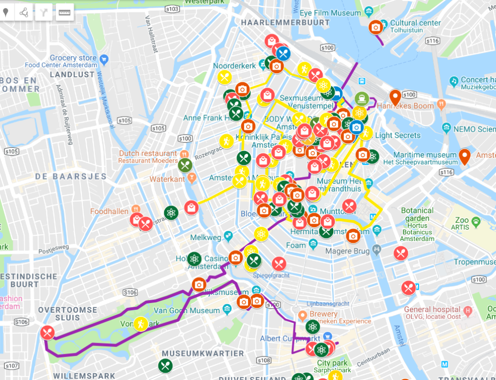
2. Google My Maps
Google My Maps is different to Google Maps. I use Google Maps for the same things everyone else probably does – working out the quickest / best route from A to B. It’s a great tool for distances and times, but you can’t save an itinerary which is where Google My Maps comes in.
Some of the things I plot with this tool are: hotel, shopping, restaurants and food places I want to try, walking routes, lookouts / viewpoints etc.
They have plenty of different icons to choose from and you can also color code EVERYTHING!
The maps can get a bit hectic if you’re plotting lots of things but it gives you a great visual representation of the best route to take to see it all, and where you should look at booking your hotel.
Related: How to choose a hotel (my step by step process)
Pros of Google My Maps
- Color code
- Use different icons for different things – food stops, photo stops etc.
- Can share your map with others
Cons of Google My Maps
- Sometimes the maps seem to have a mind of their own – when you plot a route (e.g. for a road trip) it can go way off where you want it to go
- Doesn’t give you alerts if there are timetable clashes or things aren’t open
- Doesn’t have a schedule function i.e. you can’t plot 8am we go here, 9am we go here etc.
- Printing can be annoying (I usually just do a screenshot using the snipping tool on my computer)
- Doesn’t tell you the walking / driving distances between each thing you’ve plotted
- Doesn’t have pre-done itineraries or major attractions already plotted for cities
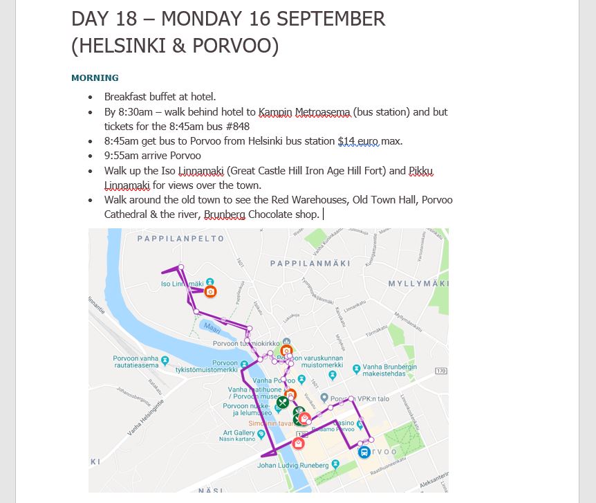
- Cannot add notes about each stop, this is why I have a schedule itinerary with notes in a Word document, then paste the screenshot of the map underneath
I Recommend using it for
- Plotting photo stops
- Short trips
- Road trips
For actual driving distances between things, I use Google Maps as I’m yet to find a way for Google My Maps to tell me driving times (only distances). If you know how to do this please comment below!
I use Google My Maps to show a summary of where I went for road trips, which I include at the front of my photo books
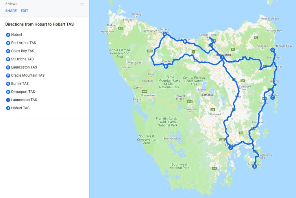
Related: Best of Tasmania Road Trip (10 Day Self Drive Itinerary)
Tutorial for using Google My Maps
To enlarge the screen of the video, click the square icon in the bottom right hand corner of the video (it will say ‘full screen’ when you hover your mouse over the icon).

Subscribe to my YouTube channel!
Other Map Plotting Options:
There are various paid mapping tools but I think free tools work just as good.
I’ve tried some of the paid ‘all in one’ type trip planning tools (map plot + store hotel booking + itinerary) but they’re too clunky. Take too long to load, so many thing to upload and import to get it set up, too many sub-menus to go through to access what you need etc.
There are many apps that you can use but I really hate apps. The small phone screen, tiny keyboard and I can’t quickly flick between tabs makes it inefficient when planing. It’s ok for referring to after planning the itinerary on a computer. I.e. I plan using the Visit a City on my computer, then refer to the app when travelling.
Travel planning tips
- Travel Planning: 50 Things to consider when planning an itinerary
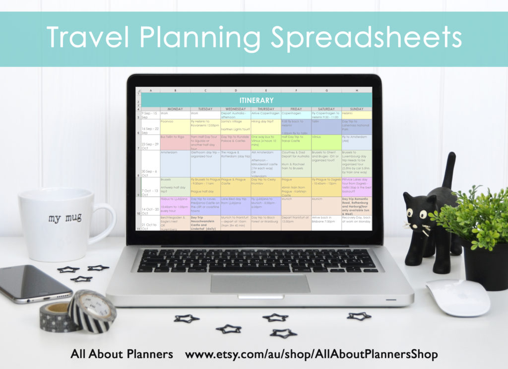
- How I use Excel to organize all my travel plans (research, itinerary, hotel, tours, bookings, packing list etc.)
- Travel Planning: How to choose a hotel (my step by step process)
Found this post helpful? Pin it!


Thank you for articles like this. I find them very helpful! I will be trying out Visit a City. I could have used something like this for my last cross country trip. Also I appreciate the time and detail you put into your blog overall. You have saved me a lot of money!!